Where Rivers, Mountains and Forests Go: Realistic Fantasy Map Geography
Readers who have never studied geography can still tell when a map is wrong. A river that splits in two halfway to the sea, a desert in the middle of a rainforest, a capital perched on a mountaintop with no water for fifty miles: something feels off, even if they cannot say what. The good news is that the rules are few, they are easy to learn, and once you know them your map starts handing you plot. Here they are, in the order you should draw them.
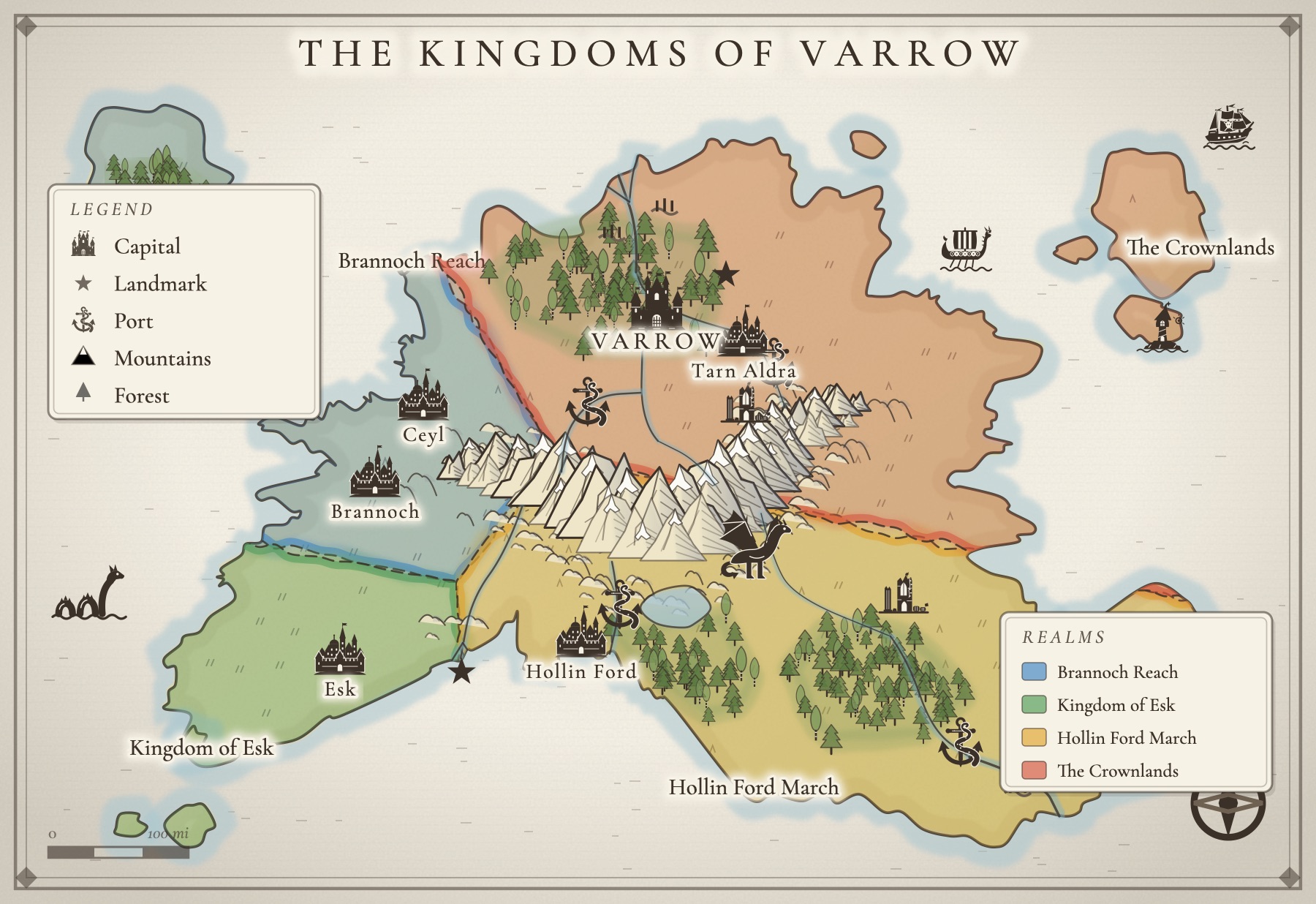
Start with the high ground
Draw the mountains first, because everything else depends on them. Mountains decide where rain falls, which way rivers run, where people can travel and where kingdoms end.
On Earth, most great ranges form where pieces of the crust collide and buckle upward, which is why mountains come in long chains, not polka dots. The Andes run down the whole western edge of South America; the Himalaya stretch across Asia for over a thousand miles. So draw your range as a spine, a long gentle curve, often running roughly parallel to a coast. Flank it with foothills on both sides, so the land steps down toward the lowlands instead of dropping off a cliff. If you want a single dramatic peak standing alone, make it a volcano, and consider what that means for the people living in its shadow.
Older ranges are lower and rounder, worn down by time; young ranges are tall and jagged. If your world has ancient history, a worn, rolling range of old hills tells that story without a word of exposition.
Rivers run downhill, and they join
This is the rule that catches the most maps. Rain falls on high ground, gathers into streams, and runs downhill by the easiest path until it reaches the sea or a lake. Along the way, streams merge: two small rivers meet and become one bigger river, which meets another, and so on. Seen from above, a river system looks like the branches of a tree, with the trunk at the coast.
- Rivers start high. Their sources are in mountains, hills or lakes, never in the middle of a flat plain for no reason.
- Rivers flow toward the sea, by the shortest downhill route. They do not climb over a range to reach a coast on the other side.
- Rivers merge but almost never split. A river does not fork inland and send half its water to one sea and half to another. The one common exception is a delta, where a big river slows down on flat ground at its mouth and fans out into several channels before it meets the sea.
- Rivers meander on flat ground and run straighter and faster in the hills. Big lazy loops tell readers they are in the lowlands.
A quick test: put your finger on any point of any river and trace it downstream. You should always reach the sea or a lake, and you should never have to choose between two directions.
Lakes keep one way out
A lake is a place where a river pauses. Water flows in from one or more streams, and almost always leaves by a single outlet that carries on downhill. Draw one river leaving each lake. The exception is a lake with no outlet at all, which only happens in dry country where the water evaporates as fast as it arrives. Those lakes turn salty, which is a gift to a writer: a salt lake in a desert basin is a strange, bright, dangerous place, and people will want to mine it.
Wind, rain and the rain shadow
Pick a direction for your prevailing wind, the way the weather usually blows. In many temperate parts of the real world it blows from the west, off the ocean. When that wet air reaches a mountain range, it is forced upward, cools, and drops its rain on the near slopes. That side is the windward side: green, wet, forested, full of rivers.
By the time the air crosses the peaks it has lost most of its water. The far side, the leeward side, sits in a rain shadow: dry grassland, scrub, and further out, desert. This is why the dry country of the Great Basin lies just east of the Sierra Nevada, and why the Patagonian steppe sits in the lee of the Andes. On your map, a lush coast, a mountain wall and a desert behind it is not a contradiction. It is one of the most believable arrangements you can draw.
Deserts also form in the dry belts on either side of the tropics, and deep inside very large continents where no sea is near enough to bring rain.
Forests follow the rain
Once you know where the rain falls, the forests place themselves. Put the big woods on the windward side of the mountains and in the river valleys, thinning out as you move into the rain shadow until they give way to grass. Rivers carry a ribbon of trees with them even through dry country.
Climate changes the kind of forest: dark pine and fir in the cold north and high up the mountains, broadleaf woods in the temperate middle, jungle where it is hot and wet all year. Marsh and wetland collect where rivers slow down near their mouths and on flat, poorly drained ground.
Coastlines and islands
Real coastlines are irregular at every scale: bays inside bays, headlands, spits and coves. Avoid smooth, rounded blobs. Let the coast reflect the land behind it. Where mountains meet the sea you get steep cliffs, deep water and, in cold places, long narrow fjords carved by old glaciers. Where rivers reach the sea across flat ground you get beaches, marshes, estuaries and deltas.
Islands rarely appear alone or at random. They come in chains (the peaks of an undersea range, or a line of volcanoes), or scattered just off a coast, where they were once part of the mainland. A string of islands curving off the end of a peninsula almost always looks right.
Where people settle
People need fresh water, food, and a way to move goods, so towns appear in predictable places. Once your geography is down, look for these spots and put settlements on them:
- River mouths and natural harbors. Where a river meets the sea, goods move between ship and boat. These become the great trading cities.
- Confluences. Where two rivers meet, two trade routes meet. A classic site for a capital.
- Fords and bridges. Where a road crosses a river, someone builds an inn, then a toll house, then a town. Look for the place name ending in “ford” or “bridge”.
- Passes. Whoever holds the only road through the mountains holds a fortress and a fortune.
- Fertile valleys on the wet side of the range, where farms feed everyone else.
Space towns along a road about a day's travel apart, since that is where travelers need a bed. Capitals go on navigable rivers or sheltered harbors, rarely on a mountaintop, and never far from water. Then look at what you have made: the pass is a border, the confluence is a prize, the harbor city is rich and resented. Geography has started writing your plot.
Break one rule, on purpose
This is a fantasy map, and magic is allowed. A river that flows uphill toward a ruined tower, a forest that grows in the heart of a desert, a mountain range that appeared overnight three hundred years ago: any of these can be the most memorable thing on your map. The trick is to break one rule deliberately and keep everything else realistic, so the impossible thing stands out as a wonder instead of reading as a mistake. And let the story notice it. If nobody in the book thinks the uphill river is strange, readers will assume you did not either.
How Inkling's world generator follows these rules
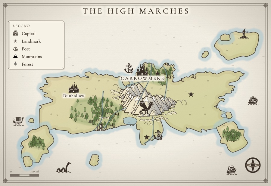
Inkling's map maker has a world generator with these rules built in, so a fresh map starts out believable and you spend your time on the parts that are yours. When it rolls a single landmass, here is what it actually does:
- A mountain spine along a collision front. It lays one long ridge across the interior, in a gentle curve, the way a range forms where two plates meet, and flanks it with lines of foothills on both sides.
- Rivers that run downhill. Sources sit just below the peaks, not on top of them, and each river runs away from the ridge toward the coast, meandering in slow bends as it goes.
- Tributaries that merge, never split. When a river reaches another, it joins it and ends there, and the meeting point is marked as a confluence. Big rivers that reach the sea may fan out into a short delta with marsh beside the mouth, and a long river sometimes pools into a lake on flat ground partway down.
- Forests on the wet side. The generator picks a windward side for the range and grows its woods in the river valleys on that side, away from the peaks. The dry side is left open, ready for you to paint in dunes, plains or badlands.
- Towns where towns grow. The capital is seated where two rivers meet or where a river reaches the sea, other towns are drawn to nearby rivers, and every settlement is nudged off the peaks and out of the forests.
Every piece stays editable. Drag a town, redraw a coastline, run a new river from the hills, carve the land into realms with colored borders, or paint terrain with soft edges. Draw a road between two towns and it bends around mountains and water on its own, the way a real road would. If you would rather begin from your own words, describe the world in a sentence, such as mountains in the north and a frozen coast, and the generator puts that terrain on that side. There are ready-made layouts too, from a single island to warring kingdoms already split into realms.
Pick a stamp, tap the realm to drop it, drag it into place, double-tap to name it.
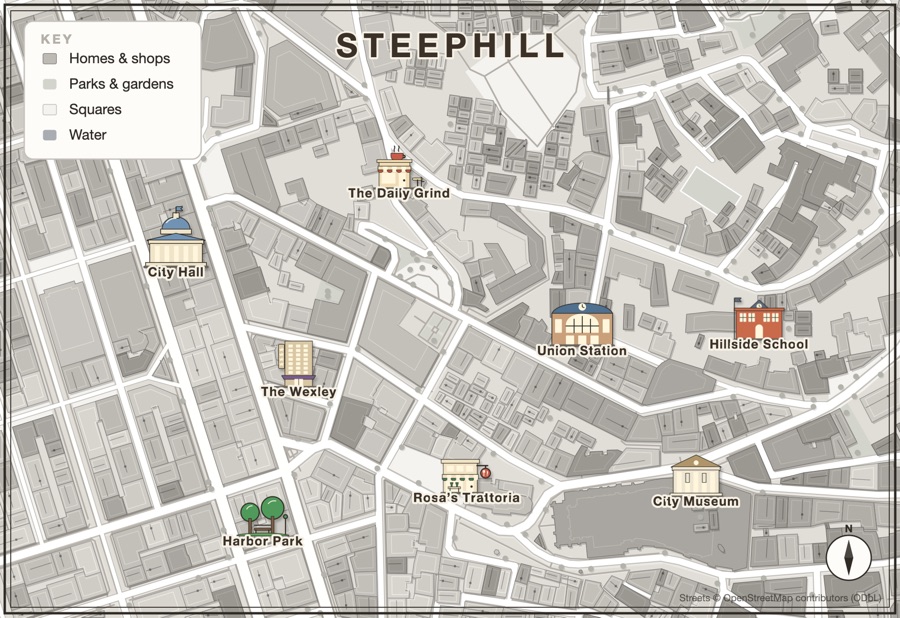
Your maps live on the same desk as your draft, your characters and your storyboard, so the map is a click away when a scene needs to know which way the river runs, and Write a story here starts a new story from any kept map with its named places already in the notes. You can start free, keeping two maps and downloading two. A Map Pass, $29 a year, keeps every map and adds unlimited downloads, print and poster sizes, SVG files and the Gilded Night style.
For the rest of the craft, read how to make a fantasy map (naming, style and making it look like the map in a real book), how to make a city map for your novel for the streets inside your capital, and how to create a fantasy world for everything that is not geography.
A few questions, answered
Do rivers ever split on a fantasy map?
Almost never. Rivers collect water as they run downhill, so small streams join into bigger ones and the shape points toward the sea. The main exception is a delta, where a river fans into several channels right at its mouth on flat ground. A river that splits inland and runs to two different seas is the most common mistake on fantasy maps.
Where should deserts go on a fantasy map?
Behind mountain ranges, on the side away from the prevailing wind, where the mountains have already wrung the rain out of the air. That is a rain shadow. Deserts also form in the dry belts north and south of the tropics and deep in the interior of very large continents, far from any sea.
How do mountains form, and where should I draw them?
Most mountain ranges form where pieces of the earth's crust push together, so they come in long chains rather than scattered single peaks, often running parallel to a coast. Draw them as a spine with foothills on either side. A lone, isolated peak is usually a volcano.
Where do towns and cities grow on a map?
Near fresh water and on routes. The classic sites are river mouths, natural harbors, the place two rivers meet, a ford or bridge where a road crosses a river, and a pass through the mountains. Capitals tend to sit on a navigable river or a sheltered harbor. Towns along a road sit roughly a day's travel apart.
Can a fantasy map break the rules of geography?
Yes, but on purpose. A river that flows uphill or a forest that grows in a desert can be the most interesting thing on your map, as long as the story notices it. Keep everything else realistic, and the one impossible thing will feel like magic instead of a mistake.
Does Inkling's map maker follow these rules?
Its world generator does. On a single landmass it lays a mountain spine across the interior like a collision front, starts rivers just below the peaks and runs them downhill to the coast, merges tributaries into one channel instead of splitting them, puts forests in the valleys on the wet side of the range, and seats the capital where rivers meet or reach the sea. You can then move, redraw or paint over anything.
All of it. In one place.
This isn't five apps stitched together. Your storyboard, your cast, your maps, your covers, and the story itself all live on one desk, right beside the words. Nothing to sync between tools. No five separate subscriptions. Just everything a writer needs, finally in the same place.